Attraction
Castelo de Cerveira
Rua do Castelo, 4920-290 Vila Nova de CerveiraOpen in Google Maps
The Invisible Shield: How Vila Nova de Cerveira Defied Empires with Earth and Ancient Stones
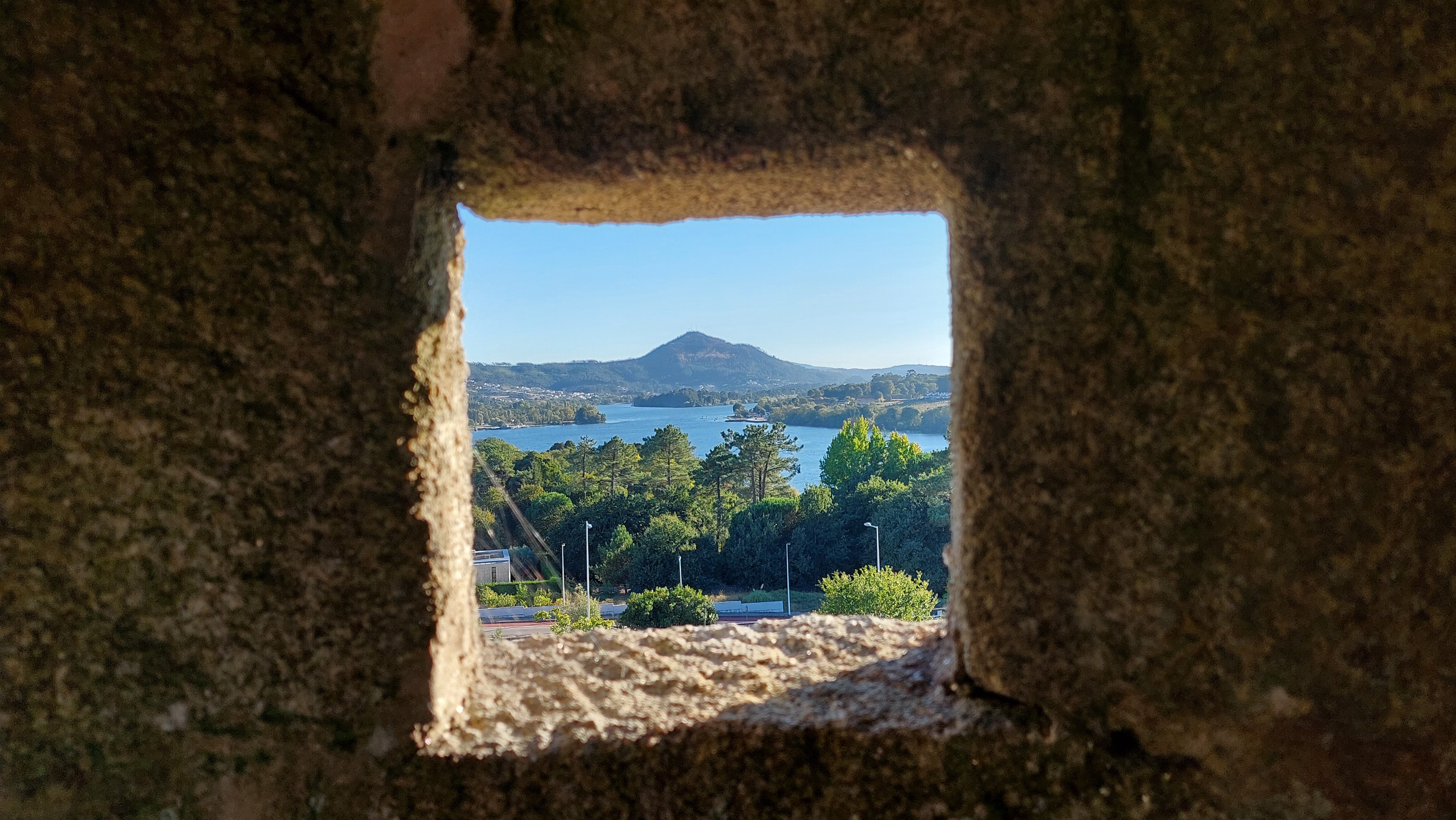
Today, the Minho River is the picture of Iberian serenity. If you stand along the riverfront promenade in Vila Nova de Cerveira, you can watch the small passenger ferry glide across the glittering water toward Goián, Spain, just a few hundred yards away. It is a quiet, idyllic landscape—yet for anyone with an eye for history, that narrow strip of water recalls a far more precarious era.
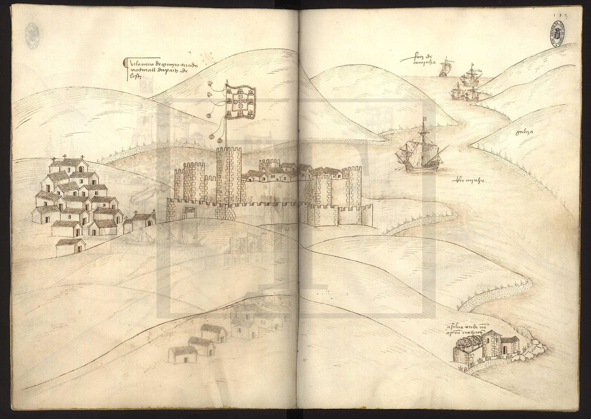
Following the Restoration of Independence in 1640, decades of neglect under the Spanish Philippine dynasty had left Portugal’s northern frontier critically exposed. Medieval castle walls were crumbling, narrow, and entirely inapt for the emerging monster of European warfare: artilharia grossa (heavy artillery).
To survive, Vila Nova de Cerveira had to reinvent itself. What followed was a masterclass in military adaptation, civilian bravery, and recycled history that turned a vulnerable border into an impenetrable defensive network.
1. The 1643 Miracle: When Civilians Repelled an Army
Cerveira’s modern trial by fire came on September 25, 1643. At the time, military reports described the town as having "the most open and worst walls" along the entire border.
Seeing an easy target, a veteran Spanish force of 2,500 infantrymen marched on the town equipped with siege ladders to scale the ramparts. With no garrison of paid soldiers stationed to defend them, 900 local residents took up arms. Under active fire, civilians worked around the clock to plug breaches, dig trenches, and erect makeshift wooden palisades (estacadas).
A contemporary dispatch presented to the 1653 Cortes captured the scale of their resistance:
"The residents of the said town and district, without any other paid people, for there were none, with their courage made the enemy retreat, killing more than 700 people, leaving many ladders and baggage behind..."
The audacity of the local population saved the town, proving that civilian grit could hold the line until formal military engineers arrived.
2. The Defensive Triangle: A Strategic Masterpiece
Following the 1643 assault, King D. João IV and Governor of Arms D. Diogo de Lima commissioned a total overhaul of the frontier. Military architects, led by engineers like Miguel de Lescole, abandoned the vertical height of medieval castles in favor of the sistema abaluartado (bastion system)—low-profile, geometric fortifications engineered to deflect cannon fire and create overlapping fields of crossfire.
The defense was anchored by an interconnected Defensive Triangle:
-
The Urban Fortress: The reinforced bastioned perimeter enclosing Vila Nova de Cerveira and protecting the ancient barca de passagem (ferry crossing).
-
Forte de Lovelhe: The northern anchor on a strategic terrace overlooking the river route toward Valença.
-
Atalaia do Lourido: A fortified watchtower perched high on the Serra da Gávea, serving as the high-altitude "eyes" monitoring troop movements across land and water.
       [Atalaia do Lourido]
       (Serra da Gávea Ridge)
              /        \
             /          \
            /            \
[Forte de Lovelhe] ---- [Urban Fortress & Ferry]
 (North Flank)          (River Crossing to Goián)
3. Anatomy of the 17th-Century Fortress (1660–1667)
Constructed rapidly between 1660 and 1667, the town’s fortifications adapted directly to the natural terrain and existing urban streets.
To withstand cannon impacts, engineers employed an ingenious "sandwich" technique: two outer retaining walls of stone (paramentos pétreos) enclosing a massive core of compacted earth and river gravel (terrapleno). The medieval castle within was converted into an inner citadel, and its towering walls were deliberately lowered (rebaixamento) to form stable artillery platforms.
| Bastion / Structure | Strategic Role | Modern Status & Location |
| Meio Baluarte de Santa Cruz | Anchored southern approaches along the riverbank | The most intact, recognizable bastion remaining today |
| Baluarte das Almas | Protected the southern road arriving from Viana | Demolished in the 19th century to lay Rua José Duro |
| Baluarte de N. Sra. da Conceição | Controlled the eastern slope facing Serra da Gávea | Preserved in fragments within the eastern historic center |
| Baluarte do Espírito Santo | Defended the northern gate (Porta de Valença) | Lost during 19th-century expansion along Rua 25 de Abril |
| Baluarte de S. Miguel | Primary northwestern bastion, once tied to outer earthworks | Subsumed near modern municipal buildings |
| Tenalha de S. Sebastião | Saw-toothed (dentes de serra) riverfront defense | Cut through in 1880 for the Minho railway line |
4. Forte de Lovelhe: 2,000 Years of Recycled History
Located just north of the town center, Forte de Lovelhe is an archaeological treasure. When 17th-century engineers fortified the hill, they were simply adding the latest layer to a site occupied across millennia:
-
Iron Age (Castro Culture): A fortified agricultural settlement defended by ancient ditches.
-
Roman Era: A bustling trade hub and villae that flourished through the 4th century AD.
-
Suebi-Visigothic Period: A post-Roman settlement that reused classical building materials.
-
17th Century: The pentagonal bastion fortress seen today.
Pressed for time during the Restoration Wars, military builders erected Lovelhe practically without standard deep foundations. Instead, they quarried the ancient Roman and Celtic ruins right beneath their feet, recycling two thousand years of granite into the fort's angled bastions and stone sentry boxes (guaritas).
5. Sinking Napoleon: The River Battle of 1809
The ultimate validation of Cerveira’s earthen defenses occurred over a century later during the Peninsular War. On February 13, 1809, Napoleon’s Marshal Soult arrived at the Minho with a battle-hardened French army, intending to cross the river and march south toward Porto.
By this time, Forte de Lovelhe was poorly garrisoned and falling into disrepair. However, coordinated artillery fire between Lovelhe and the nearby Bateria da Mota caught the French flotilla in a deadly crossfire mid-river.
The Governor of the Plaza, Gonçalo Coelho Araújo, recorded the moment:
"Then the Fort of Lovelhe fired at the other boats that were coming out and, sinking some, made the others retreat; and repeating another shot at the house of D. Antónia Correia... I saw the troops that were there flee precipitately."
The defense held. Soult was forced to abandon the river crossing entirely, diverting his army inland across the mountains through Chaves.
6. How to Explore Cerveira’s Hidden Defenses Today
While the 19th and 20th centuries dismantled much of the outer perimeter to make way for roads, railways, and municipal gardens, the footprint of the fortress remains woven into modern Vila Nova de Cerveira.
Walking Route:
[Baluarte de Santa Cruz]
       ↓ (Walk north along river)
[Medieval Castle / Citadel]
       ↓ (Follow Rua José Duro / 25 de Abril)
[Historic Urban Center]
       ↓ (Short drive / walk north)
[Forte de Lovelhe]
       ↓ (Hike up Serra da Gávea)
[Atalaia do Lourido Panoramic Viewpoint]
-
Start at Baluarte de Santa Cruz: Located along the riverbank, this half-bastion is the clearest place to observe the angled stone-and-earth profile of 17th-century military engineering.
-
Walk the Perimeter of the Castle Citadel: Head inside the historic core to see where medieval towers were cut down to accommodate heavy cannon mounts.
-
Trace the Missing Moats: As you walk down Rua José Duro and past the Jardim de Chagny, notice how the modern street level sits directly inside the filled-in military ditches.
-
Visit Lovelhe and Atalaia do Lourido: Finish with a trip to Forte de Lovelhe to see the recycled multi-era masonry, then head up the slopes of Serra da Gávea to the Atalaia watchtower for a panoramic view over the entire Minho valley.